Just you younger folks are fully informed, these CAB route maps were not intended to show the full array of nonstop routes operated by each carrier.
The lines connecting the dots might vary, but I don't think you're going to find any dots missing.
As I understand CAB route authority, any intermediate point along a given route could be served from any terminal point along that route, unless otherwise prohibited by the CAB.
In the case of TUS, which is on Route 4, nonstop service to every destination you mentioned (SAN/LAX/SFO/PHX/ELP/DFW/ORD) was permitted, as was nonstop service to the terminal points of STL, SAT, IAH, OAK, EWR, BWI, CVG, JFK, DTW, CLE, and LGA. Service between intermediate points (i.e. TUS-BNA or TUS-TUL) could only be operated thru a terminal point, and even there, it was often specifically prohibited or restricted as to where the thru service could originate and terminate.
Likewise, on DL's map, there isn't a nonstop on ATL-ORD, however both are terminal points along Route 54, so nonstops would be permitted.
Also, for some unknown reason Scranton/Wilkes-Barre and Monterey (Mexico) are both shown, although AA had dropped service to both years before (late 50s/early 60s).
The scanned map is a summary of all routes and destinations authorized for the carrier. It's not practical for me to have scanned all of the route maps for each carrier -- there are about 80 pages of them for the variou carriers.
On the detail maps for Route 56 and Route 134, both destinations you mention show as service suspended, as does ELP, which was designated as a US gateway along with SAT (with restrictions) and DFW.
Thirdly, AA's Caribbean system is not shown or even alluded to.
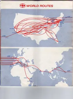
These were domestic system maps. Aside from the tranborder flights to Canada and Mexico, there aren't any international routes showing for NWA, TWA, or Pan Am.
The route maps in the AA timetables of the era are a better indicator of the true nature of their service at the time.
Perhaps, but the point of showing the CAB maps was to give an idea of how the country was carved up under regulation, and how restrictive it was for a given carrier to operate.